

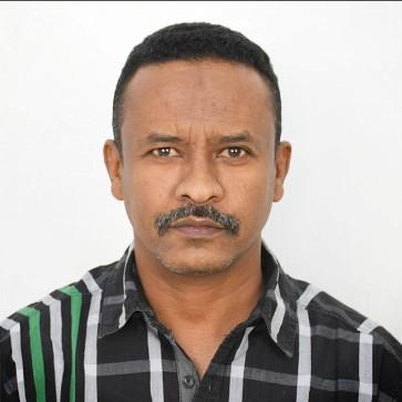
MOHAMMED YOUSIF
Riyadh,Riyadh Region
Summary
Senior Survey Manager with over 22 years of experience leading surveying operations for major infrastructure, transportation, urban development, utility and construction projects across Saudi Arabia and Sudan. Experienced in survey management, geodetic control, construction setting-out, QA/QC, stakeholder coordination and digital survey technologies.
Overview
2
2
Languages
4
4
years of post-secondary education
21
21
years of professional experience
Work history
Senior Survey Manager
Dar Al-Handasah Consultants (Shair and Partners)
Riyadh, Riyadh Region
03.2014 - Current
Survey Team Leader / Senior Surveyor
October 2014 – August 2026
Projects:
Wadi Al-Sulai Development Project, Riyadh
April 2023 – August 2026
- Led survey teams in carrying out topographic, construction, and as-built surveys.
- Managed survey activities to support infrastructure development works.
- Ensured survey accuracy and compliance with project specifications.
Confidential Project
July 2022 – April 2023
- Supervised survey operations for a confidential development project.
- Coordinated field survey activities and quality control procedures.
Qiddiya Development Project
November 2019 – July 2022
- Managed surveying works for major infrastructure and development projects.
- Performed setting out, verification surveys, and as-built measurements.
- Coordinated with engineers, contractors, and project management teams.
Government Complex Project, Riyadh
November 2014 – December 2019
- Conducted engineering and construction surveys.
- Performed layout, control, and monitoring surveys.
- Prepared survey reports and maintained project survey records.
Custodian of the Two Holy Mosques Expansion Project – Prophet's Mosque, Madinah
October 2014 – November 2014
- Participated in survey operations for the expansion project.
- Executed precise control and setting-out surveys.
Senior Survey
Eng. Samir Engineering Consultancy Office – Saleh
Makkah, Mecca Region
01.2009 - 03.2014
Survey Team Leader
July 2009 – Present
Responsibilities:
Supervised surveying works for road projects under the Holy Makkah Municipality.
Supervised surveying activities for Al-Jumum Municipality projects.
Supervised surveying activities for Asfan Municipality projects.
Led the survey team for the Makkah Development Projects (Jabal Al-Noor and Jabal Thawr).
Led the survey team for the Makkah Urban Redevelopment (Hadd) Project.
Survey Engineer
Ministry of Irrigation and Water Resources
Khartoum, Sudan
02.2006 - 06.2009
Responsibilities:
- Supervised the implementation of the Al-Hilaliya Agricultural Project.
- Supervised relief and development projects in White Nile State.
- Conducted studies and supervised the rehabilitation of irrigation canals in the Gezira Agricultural Scheme.
Survey Engineer
Al-Marafi Roads and Bridges Company
khartoum, Sudan
11.2005 - 02.2006
- Drafted detailed drawings using AutoCAD to aid in decision making processes.
- Delivered efficient results by implementing innovative survey techniques.
- Established clear communication channels among all stakeholders involved in a project.
Education
Diploma - 3years in Surveying Engineering
Sudan University of Science and Technology
Khartoum /Sudan 02.2000 - 05.2004
Bachelor's Degree with Honours - Geoinformatics at final year
Future university
Khartoum/Sudan 11.2024 -
Skills
Survey leadership and execution planning for multi-discipline infrastructure, construction, aviation, road, utility, cadastral, and land development projects
Team and resource coordination, including supervision of survey crews, assistants, technicians, instrument setup, calibration control, field assignments, and daily productivity follow-up
Topographic surveys, cadastral and boundary surveys, geodetic control, construction staking, road and airfield setting-out, grading checks, cross-sections, earthwork quantities, and as-built surveys
Survey QA/QC review of contractor setting-out, control points, benchmarks, coordinates, elevations, drawings, shop drawings, as-built submissions, and final survey deliverables
Technical oversight of Total Station, GPS/GNSS RTK/Static/DGPS, digital levels, data collectors, Leica, Trimble, Topcon, AutoCAD Civil 3D, Leica Geo Office, and Trimble Business Centre
Compliance with project specifications, Saudi construction requirements, municipal and client procedures, safety standards,
Stakeholder coordination and reporting with clients, consultants, contractors, design engineers, construction supervision teams, civil, structural, architectural, MEP, electrical, and QA/QC teams
Working familiarity with GIS, BIM-managed projects, digital survey records, land-information systems, and geospatial data management workflows
Courses & Training :
Online Courses -:
5 Courses: Diploma of Geographic Information Systems Specialization from University of California, Davis
Course (1) Fundamentals of GIS
Course (2) GIS Data Formats, Design and Quality
Course (3) Geospatial and Environmental Analysis
Course (4) Imagery, Automation, and Applications
Course (5) Geospatial Analysis project
Computer and Technical skills :-
GIS software:
Arc GIS desktop package ( Arc Map - Arc Scene - Arc Globe - Arc CatLog – Arc Toolbox)
Arc Online(Dashboard - Survey123 - Story map - Web app-map viewer beta- map viewer classic-wep app builder)
ArcGIS Pro
Google earth
QGIS Desktop
Survey tools: (Level, Total Station) and software: (AutoCAD)
Microsoft office
( all documents are available upon request )
Languages
Arabic
Fluent
English
Upper intermediate (B2)
Timeline
Bachelor's Degree with Honours - Geoinformatics at final year
Future university
11.2024 -
Senior Survey Manager
Dar Al-Handasah Consultants (Shair and Partners)
03.2014 - Current
Senior Survey
Eng. Samir Engineering Consultancy Office – Saleh
01.2009 - 03.2014
Survey Engineer
Ministry of Irrigation and Water Resources
02.2006 - 06.2009
Survey Engineer
Al-Marafi Roads and Bridges Company
11.2005 - 02.2006
Diploma - 3years in Surveying Engineering
Sudan University of Science and Technology
02.2000 - 05.2004